The FEMA Elevation Certificate plays a crucial role in the National Flood Insurance Program (NFIP), serving as a key document to provide necessary elevation information for buildings situated in flood-prone areas. This form assists communities in managing floodplain regulations and helps property owners determine their insurance premium rates. By accurately documenting the elevation of the lowest floor of new or substantially improved structures, the certificate supports requests for crucial amendments, such as Letters of Map Amendment (LOMA) and Letters of Map Revision based on fill (LOMR-F). It is important to note that the certificate is specifically required for buildings constructed after the issuance of the Flood Insurance Rate Map (FIRM) and located in specific flood insurance zones like AE and VE. Community officials use the data included in this certificate to ensure compliance with ordinances aimed at reducing flood losses. Moreover, the information collected helps determine if a property qualifies for flood insurance and can significantly impact insurance costs. Although the certificate includes a multitude of data points, such as geographic coordinates and flood zone designations, it emphasizes that the disclosure of information is voluntary. However, not providing the requested data may lead to difficulties in obtaining flood insurance. Understanding and completing the FEMA Elevation Certificate accurately is essential for property owners, since it establishes the groundwork for being adequately insured against potential flood damages.
NATIONAL FLOOD INSURANCE PROGRAM
ELEVATION CERTIFICATE
AND
INSTRUCTIONS
2019 EDITION
OMB No.
Expiration Date: November 30, 2022
U.S. DEPARTMENT OF HOMELAND SECURITY
Federal Emergency Management Agency
National Flood Insurance Program
ELEVATION CERTIFICATE AND INSTRUCTIONS
Paperwork Reduction Act Notice
Public reporting burden for this data collection is estimated to average 3.75 hours per response. The burden estimate includes the time for reviewing instructions, searching existing data sources, gathering and maintaining the data needed, and completing and submitting this form. You are not required to respond to this collection of information unless a valid OMB control number is displayed on this form. Send comments regarding the accuracy of the burden estimate and any suggestions for reducing the burden to: Information Collections Management, Department of Homeland Security, Federal Emergency Management Agency, 500 C Street SW, Washington, DC 20742, Paperwork Reduction Project
Privacy Act Statement
Authority: Title 44 CFR § 61.7 and 61.8.
Principal Purpose(s): This information is being collected for the primary purpose of estimating the risk premium rates necessary to provide flood insurance for new or substantially improved structures in designated Special Flood Hazard Areas.
Routine Use(s): The information on this form may be disclosed as generally permitted under 5 U.S.C. § 552a(b) of the Privacy Act of 1974, as amended. This includes using this information as necessary and authorized by the routine uses published in DHS/
Disclosure: The disclosure of information on this form is voluntary; however, failure to provide the information requested may result in the inability to obtain flood insurance through the National Flood Insurance Program or the applicant may be subject to higher premium rates for flood insurance. Information will only be released as permitted by law.
Purpose of the Elevation Certificate
The Elevation Certificate is an important administrative tool of the National Flood Insurance Program (NFIP). It is to be used to provide elevation information necessary to ensure compliance with community floodplain management ordinances, to determine the proper insurance premium rate, and to support a request for a Letter of Map Amendment (LOMA) or Letter of Map Revision based on fill
The Elevation Certificate is required in order to properly rate
As part of the agreement for making flood insurance available in a community, the NFIP requires the community to adopt floodplain management regulations that specify minimum requirements for reducing flood losses. One such requirement is for the community to obtain the elevation of the lowest floor (including basement) of all new and substantially improved buildings, and maintain a record of such information. The Elevation Certificate provides a way for a community to document compliance with the community's floodplain management ordinance.
Use of this certificate does not provide a waiver of the flood insurance purchase requirement. Only a LOMA or
This certificate is used only to certify building elevations. A separate certificate is required for floodproofing. Under the NFIP, non- residential buildings can be floodproofed up to or above the Base Flood Elevation (BFE). A floodproofed building is a building that has been designed and constructed to be watertight (substantially impermeable to floodwaters) below the BFE. Floodproofing of residential buildings is not permitted under the NFIP unless FEMA has granted the community an exception for residential floodproofed basements. The community must adopt standards for design and construction of floodproofed basements before FEMA will grant a basement exception. For both floodproofed
Additional guidance can be found in FEMA Publication
FEMA Form |
Replaces all previous editions. |

U.S. DEPARTMENT OF HOMELAND SECURITY Federal Emergency Management Agency
National Flood Insurance Program
OMB No.
Expiration Date: November 30, 2022
ELEVATION CERTIFICATE
Important: Follow the instructions on pages
Copy all pages of this Elevation Certificate and all attachments for (1) community official, (2) insurance agent/company, and (3) building owner.
|
|
SECTION A – PROPERTY INFORMATION |
FOR INSURANCE COMPANY USE |
|
|
A1. Building Owner's Name |
Policy Number: |
||
|
|
|
|
|
|
A2. Building Street Address (including Apt., Unit, Suite, and/or Bldg. No.) or P.O. Route and |
Company NAIC Number: |
||
|
Box No. |
|
||
|
|
|
|
|
|
|
|
|
|
|
City |
State |
ZIP Code |
|
A3. Property Description (Lot and Block Numbers, Tax Parcel Number, Legal Description, etc.)
A4. Building Use (e.g., Residential, |
|
|
|
|
|
|
|||||||||||||||
A5. Latitude/Longitude: Lat. |
|
|
|
|
|
Long. |
|
|
|
Horizontal Datum: |
NAD 1927 |
NAD 1983 |
|||||||||
A6. Attach at least 2 photographs of the building if the Certificate is being used to obtain flood insurance. |
|
|
|
|
|||||||||||||||||
A7. Building Diagram Number |
|
|
|
|
|
|
|
|
|
|
|
|
|
|
|
|
|
|
|
||
A8. For a building with a crawlspace or enclosure(s): |
|
|
|
|
|
|
|||||||||||||||
a) |
Square footage of crawlspace or enclosure(s) |
|
sq ft |
|
|
|
|
||||||||||||||
|
|
|
|
|
|
|
|
|
|
|
|
|
|||||||||
b) |
Number of permanent flood openings in the crawlspace or enclosure(s) within 1.0 foot above adjacent grade |
|
|
|
|||||||||||||||||
c) |
Total net area of flood openings in A8.b |
|
|
|
|
|
sq in |
|
|
|
|
|
|
||||||||
d) Engineered flood openings? |
Yes |
No |
|
|
|
|
|
|
|||||||||||||
A9. For a building with an attached garage: |
|
|
|
|
|
|
|
|
|
|
|
|
|
||||||||
a) |
Square footage of attached garage |
|
|
|
|
|
|
|
|
sq ft |
|
|
|
|
|
|
|||||
b) |
Number of permanent flood openings in the attached garage within 1.0 foot above adjacent grade |
|
|
|
|
||||||||||||||||
c) |
Total net area of flood openings in A9.b |
|
|
|
|
|
|
sq in |
|
|
|
|
|
|
|||||||
d) Engineered flood openings? |
Yes |
No |
|
|
|
|
|
|
|||||||||||||
SECTION B – FLOOD INSURANCE RATE MAP (FIRM) INFORMATION
B1. NFIP Community Name & Community Number
B2. County Name
B3. State
B4. Map/Panel
Number
B5. Suffix
B6. FIRM Index Date
B7. FIRM Panel
Effective/
Revised Date
B8. Flood Zone(s)
B9. Base Flood Elevation(s)
(Zone AO, use Base Flood Depth)
B10. Indicate the source of the Base Flood Elevation (BFE) data or base flood depth entered in Item B9:
FIS Profile |
FIRM |
Community Determined |
Other/Source: |
B11. Indicate elevation datum used for BFE in Item B9: NGVD 1929 |
NAVD 1988 |
Other/Source:
B12. Is the building located in a Coastal Barrier Resources System (CBRS) area or Otherwise Protected Area (OPA)? |
Yes |
No |
|||
Designation Date: |
|
CBRS |
OPA |
|
|
FEMA Form |
Replaces all previous editions. |
Form Page 1 of 6 |
ELEVATION CERTIFICATE |
|
|
OMB No. |
|
|
|
Expiration Date: November 30, 2022 |
||
IMPORTANT: In these spaces, copy the corresponding information from Section A. |
FOR INSURANCE COMPANY USE |
|||
Building Street Address (including Apt., Unit, Suite, and/or Bldg. No.) or P.O. Route and Box No. |
Policy Number: |
|||
|
|
|
|
|
City |
State |
ZIP Code |
Company NAIC Number |
|
|
|
|
|
|
SECTION C – BUILDING ELEVATION INFORMATION (SURVEY REQUIRED)
C1. Building elevations are based on: |
Construction Drawings* |
Building Under Construction* |
Finished Construction |
*A new Elevation Certificate will be required when construction of the building is complete. |
|
||
C2. Elevations – Zones
Benchmark Utilized: |
|
|
|
|
Vertical Datum: |
|
|
|
|
|
||
Indicate elevation datum used for the elevations in items a) through h) below. |
|
|
|
|
||||||||
|
NGVD 1929 |
NAVD 1988 |
Other/Source: |
|
|
|
|
|
||||
Datum used for building elevations must be the same as that used for the BFE. |
Check the measurement used. |
|||||||||||
|
|
|
|
|
|
|
|
|
||||
a) |
Top of bottom floor (including basement, crawlspace, or enclosure floor) |
|
feet |
meters |
||||||||
b) |
Top of the next higher floor |
|
|
|
|
|
|
feet |
meters |
|||
c) |
Bottom of the lowest horizontal structural member (V Zones only) |
|
|
feet |
meters |
|||||||
d) |
Attached garage (top of slab) |
|
|
|
|
|
|
feet |
meters |
|||
e) |
Lowest elevation of machinery or equipment servicing the building |
|
feet |
meters |
||||||||
|
(Describe type of equipment and location in Comments) |
|
|
|||||||||
|
|
|
feet |
meters |
||||||||
f) |
Lowest adjacent (finished) grade next to building (LAG) |
|
|
|||||||||
g) |
Highest adjacent (finished) grade next to building (HAG) |
|
|
feet |
meters |
|||||||
h) |
Lowest adjacent grade at lowest elevation of deck or stairs, including |
|
feet |
meters |
||||||||
|
structural support |
|
|
|
|
|
|
|
||||
SECTION D – SURVEYOR, ENGINEER, OR ARCHITECT CERTIFICATION
This certification is to be signed and sealed by a land surveyor, engineer, or architect authorized by law to certify elevation information. I certify that the information on this Certificate represents my best efforts to interpret the data available. I understand that any false statement may be punishable by fine or imprisonment under 18 U.S. Code, Section 1001.
Were latitude and longitude in Section A provided by a licensed land surveyor? |
Yes |
No |
Check here if attachments. |
||
|
|
|
|
|
|
Certifier's Name |
License Number |
|
|
|
|
|
|
|
|
|
|
Title |
|
|
|
|
|
|
|
|
|
|
|
Company Name |
|
|
|
|
|
|
|
|
|
|
|
Address |
|
|
|
|
|
|
|
|
|
|
|
City |
State |
ZIP Code |
|
|
|
|
|
|
|
|
|
Signature |
Date |
Telephone |
|
Ext. |
|
Copy all pages of this Elevation Certificate and all attachments for (1) community official, (2) insurance agent/company, and (3) building owner. Comments (including type of equipment and location, per C2(e), if applicable)
FEMA Form |
Replaces all previous editions. |
Form Page 2 of 6 |

ELEVATION CERTIFICATE |
|
|
OMB No. |
|
|
|
Expiration Date: November 30, 2022 |
||
IMPORTANT: In these spaces, copy the corresponding information from Section A. |
FOR INSURANCE COMPANY USE |
|||
Building Street Address (including Apt., Unit, Suite, and/or Bldg. No.) or P.O. Route and Box No. |
Policy Number: |
|||
|
|
|
|
|
City |
State |
ZIP Code |
Company NAIC Number |
|
SECTION E – BUILDING ELEVATION INFORMATION (SURVEY NOT REQUIRED)
FOR ZONE AO AND ZONE A (WITHOUT BFE)
For Zones AO and A (without BFE), complete Items
E1. Provide elevation information for the following and check the appropriate boxes to show whether the elevation is above or below the highest adjacent grade (HAG) and the lowest adjacent grade (LAG).
a)Top of bottom floor (including basement, crawlspace, or enclosure) is
b)Top of bottom floor (including basement, crawlspace, or enclosure) is
feet |
meters |
above or |
below the HAG. |
feet |
meters |
above or |
below the LAG. |
E2. |
For Building Diagrams |
||||||||
|
the next higher floor (elevation C2.b in |
|
|
|
|
feet |
meters |
above or |
below the HAG. |
|
the diagrams) of the building is |
|
|
|
|
||||
E3. |
Attached garage (top of slab) is |
|
|
|
|
feet |
meters |
above or |
below the HAG. |
|
|
|
|
||||||
E4. |
Top of platform of machinery and/or equipment |
|
|
|
|
|
|
|
|
|
servicing the building is |
|
|
|
|
feet |
meters |
above or |
below the HAG. |
|
|
|
|
|
|||||
E5. |
Zone AO only: If no flood depth number is available, is the top of the bottom floor elevated in accordance with the community's |
||||||||
|
floodplain management ordinance? |
Yes |
No |
Unknown. The local official must certify this information in Section G. |
|||||
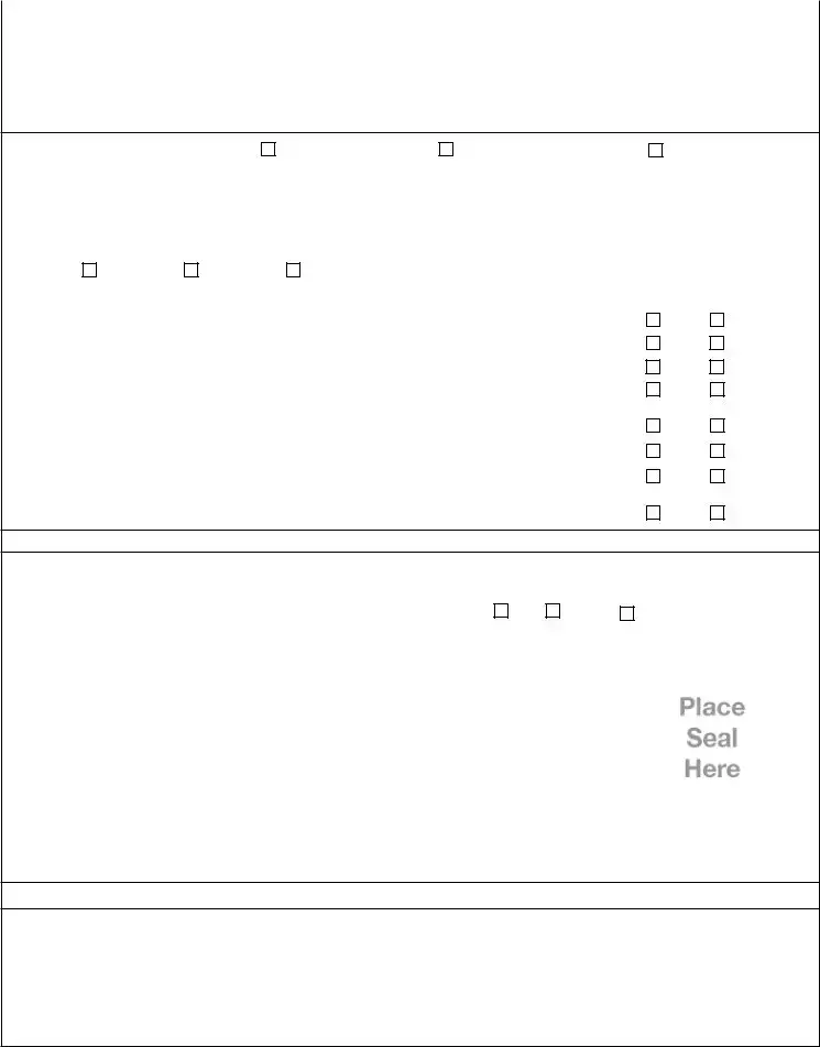
SECTION F – PROPERTY OWNER (OR OWNER'S REPRESENTATIVE) CERTIFICATION
The property owner or owner's authorized representative who completes Sections A, B, and E for Zone A (without a
Property Owner or Owner's Authorized Representative's Name
|
Address |
City |
State |
ZIP Code |
|
|
|
|
|
|
|
|
Signature |
Date |
Telephone |
|
|
|
|
|
|
|
|
|
Comments |
|
|
|
|
|
|
Check here if attachments. |
|
|
|
FEMA Form |
Replaces all previous editions. |
Form Page 3 of 6 |

ELEVATION CERTIFICATE
OMB No.
Expiration Date: November 30, 2022
IMPORTANT: In these spaces, copy the corresponding information from Section A. |
FOR INSURANCE COMPANY USE |
|||
Building Street Address (including Apt., Unit, Suite, and/or Bldg. No.) or P.O. Route and Box No. |
Policy Number: |
|||
|
|
|
|
|
City |
State |
ZIP Code |
Company NAIC Number |
|
|
|
|
|
|
|
SECTION G – COMMUNITY INFORMATION (OPTIONAL) |
|
|
|
The local official who is authorized by law or ordinance to administer the community's floodplain management ordinance can complete Sections A, B, C (or E), and G of this Elevation Certificate. Complete the applicable item(s) and sign below. Check the measurement used in Items
G1.
The information in Section C was taken from other documentation that has been signed and sealed by a licensed surveyor, engineer, or architect who is authorized by law to certify elevation information. (Indicate the source and date of the elevation data in the Comments area below.)
G2.
G3.
A community official completed Section E for a building located in Zone A (without a
The following information (Items
G4. Permit Number
G5. Date Permit Issued
G6. Date Certificate of Compliance/Occupancy Issued
G7. This permit has been issued for: |
New Construction |
Substantial Improvement |
G8. Elevation of
G9. BFE or (in Zone AO) depth of flooding at the building site:
G10. Community's design flood elevation:
Local Official's Name |
Title |
 feet
feet 
 meters Datum
 feet
feet 
 meters Datum
 feet
feet 
 meters Datum
Community Name |
Telephone |
Signature |
Date |
Comments (including type of equipment and location, per C2(e), if applicable)
Check here if attachments.
FEMA Form |
Replaces all previous editions. |
Form Page 4 of 6 |

ELEVATION CERTIFICATE |
BUILDING PHOTOGRAPHS |
OMB No. |
||
See Instructions for Item A6. |
Expiration Date: November 30, 2022 |
|||
IMPORTANT: In these spaces, copy the corresponding information from Section A. |
FOR INSURANCE COMPANY USE |
|||
Building Street Address (including Apt., Unit, Suite, and/or Bldg. No.) or P.O. Route and Box No. |
Policy Number: |
|||
|
|
|
|
|
City |
State |
ZIP Code |
Company NAIC Number |
|
|
|
|
|
|
If using the Elevation Certificate to obtain NFIP flood insurance, affix at least 2 building photographs below according to the instructions for Item A6. Identify all photographs with date taken; "Front View" and "Rear View"; and, if required, "Right Side View" and "Left Side View." When applicable, photographs must show the foundation with representative examples of the flood openings or vents, as indicated in Section A8. If submitting more photographs than will fit on this page, use the Continuation Page.
|
Photo One |
||
Photo One Caption |
|
Clear Photo One |
|
|
|
|
|
|
Photo Two |
||
Photo Two Caption |
|
Clear Photo Two |
|
|
|
|
|
FEMA Form |
Replaces all previous editions. |
Form Page 5 of 6 |

ELEVATION CERTIFICATE |
BUILDING PHOTOGRAPHS |
OMB No. |
|
|
Continuation Page |
Expiration Date: November 30, 2022 |
|
IMPORTANT: In these spaces, copy the corresponding information from Section A. |
FOR INSURANCE COMPANY USE |
||
Building Street Address (including Apt., Unit, Suite, and/or Bldg. No.) or P.O. Route and Box No. |
Policy Number: |
||
|
|
|
|
City |
State |
ZIP Code |
Company NAIC Number |
|
|
|
|
If submitting more photographs than will fit on the preceding page, affix the additional photographs below. Identify all photographs with: date taken; "Front View" and "Rear View"; and, if required, "Right Side View" and "Left Side View." When applicable, photographs must show the foundation with representative examples of the flood openings or vents, as indicated in Section A8.
|
Photo Three |
Photo Three Caption |
Clear Photo Three |
|
Photo Four |
||
Photo Four Caption |
|
Clear Photo Four |
|
|
|
|
|
FEMA Form |
Replaces all previous editions. |
Form Page 6 of 6 |
| Fact Name | Description |
|---|---|
| Purpose of the Elevation Certificate | The Elevation Certificate serves to provide necessary elevation information for flood insurance compliance and risk assessment. |
| Required for Post-FIRM Buildings | This form is mandatory for Post-FIRM buildings in designated flood zones, except for those rated under optional Post-FIRM rules. |
| Community Regulations | Communities must adopt floodplain management regulations. These require maintaining the elevation of new or substantially improved buildings. |
| Information Disclosure | Disclosure of information on the form is voluntary; however, it is essential for obtaining flood insurance and avoiding higher premium rates. |
| Certification Requirement | The certificate must be signed and sealed by a licensed surveyor, engineer, or architect to validate the elevation information provided. |
| Floodproofing Conditions | Non-residential buildings can be floodproofed to meet specified standards. However, residential floodproofing is generally not allowed unless exceptions are granted. |
| State-Specific Regulations | Various states have their regulations governing the NFIP and Elevation Certificate usage. Check with your local authority for specific laws. |
Filling out the FEMA Elevation Certificate is a vital step in obtaining flood insurance and ensuring compliance with local regulations. The form requires accurate information about your property's elevation and relevant flood zone details. After completing the form, you must submit it to your local authority and keep copies for yourself, your insurance agent, and your community officials.
What is the purpose of the FEMA Elevation Certificate?
The FEMA Elevation Certificate serves multiple essential functions. Primarily, it provides crucial elevation information needed to comply with local floodplain management regulations. This information helps determine appropriate flood insurance premium rates for properties, particularly those built or improved after the Flood Insurance Rate Map (FIRM) was published. Furthermore, the certificate is required for properties in designated Special Flood Hazard Areas and plays an important role in supporting requests for Letter of Map Amendments (LOMA) or Letter of Map Revisions based on fill (LOMR-F). It captures vital details that communities need to record for effective flood risk management.
Who needs an Elevation Certificate?
Individuals and communities dealing with properties in Special Flood Hazard Areas typically need an Elevation Certificate. Specifically, it’s required for buildings constructed after the FIRM was published, often referred to as Post-FIRM buildings. While it isn’t compulsory for Pre-FIRM buildings unless being rated under new insurance rules, obtaining one can help mitigate flood insurance costs. Homeowners, builders, and insurance agents commonly seek this certificate for various reasons, including compliance and the need for accurate insurance premium calculation.
How is the Elevation Certificate completed and who should fill it out?
The Elevation Certificate must be filled out by a licensed land surveyor, engineer, or architect. Various sections of the form require specific information about the building's location, use, and measurements. Accurate elevation data must be provided, including details like the lowest floor elevation and adjacent grades. It is critical that this professional uses precise construction drawings or measurements to ensure that the information is reliable. Incomplete or inaccurate information may lead to issues with obtaining flood insurance.
Can Elevation Certificates potentially alter flood insurance requirements?
While the Elevation Certificate itself does not waive the flood insurance purchase requirement, it can be instrumental in lowering premium rates. Moreover, if the elevation data suggests that a property is above the Base Flood Elevation (BFE), it may support a request for a LOMA or LOMR-F. Should FEMA grant these requests, it can remove the federal mandate for flood insurance, significantly impacting homeowners' and lenders' insurance obligations. However, lending institutions may still independently require flood insurance regardless of FEMA’s findings.
What happens if someone doesn’t submit an Elevation Certificate?
Failure to submit an Elevation Certificate may lead to heightened flood insurance premiums or, potentially, the inability to obtain flood insurance from the National Flood Insurance Program (NFIP). For homeowners in designated flood zones, this can have severe financial implications. It is vital to comply with community regulations and ensure that accurate elevation data is provided to mitigate costs related to future flood risks.
Is there a specific format or guidelines for submitting the Elevation Certificate?
Yes, the Elevation Certificate must adhere to the format provided by FEMA. It includes several sections that require specific information, such as property details, flood zone data, and certified elevations. Each section serves a unique purpose in documenting compliance with floodplain management requirements. It’s essential for property owners to copy and maintain all pages and attachments of the certified document for their records and for submission to relevant parties, including community officials and insurance agents.
Omitting required signatures. Both the surveyor and property owner must sign the form. Failing to secure these signatures could delay or invalidate the certificate.
Inaccurate property information. Providing incorrect details such as the building address or legal description can lead to complications with insurance processing.
Wrong base flood elevation data. Incorrect or outdated Base Flood Elevation (BFE) information can result in improper flood insurance premium rates and might lead to disputes.
Neglecting to include all required photos. Not attaching at least two photographs of the building could hinder flood insurance applications, particularly if they require visual documentation.
Improperly measuring elevations. Failure to utilize the correct elevation datum can cause miscalculations in building heights, affecting compliance with floodplain regulations.
Using the wrong form sections. Completing sections not applicable to the building type can confuse the certifying authority and delay the documentation process.
Not providing a licensed surveyor’s information. If the latitude and longitude are not supplied by an approved surveyor, it might result in rejection of the form.
Ignoring local floodplain management ordinances. Disregarding local requirements when filling out the form can lead to non-compliance issues with the community.
Failing to double-check for completeness. Missing items or leaving sections blank can jeopardize the application, necessitating retrials and prolonged processing times.
Not understanding the implications of the Elevation Certificate. Misinterpretation of the certificate's purpose could result in failure to obtain necessary flood insurance or misrating.
The FEMA Elevation Certificate is crucial for establishing a building's elevation in relation to flood risk. However, there are several other documents that often accompany this form, which are necessary for compliance and insurance purposes. Understanding these documents will facilitate the flood insurance process.
Obtaining these forms and ensuring they are properly filled out will streamline your interactions with FEMA and insurance providers. This can ultimately impact the availability and cost of flood insurance for your property. Prompt attention to these items is essential for protecting your investment against flood risks.
The FEMA Elevation Certificate shares similarities with the "Floodproofing Certificate." Both documents are essential under the National Flood Insurance Program (NFIP) for ensuring that buildings meet flood protection standards. The Floodproofing Certificate specifically applies to non-residential structures designed to withstand floodwaters. Like the Elevation Certificate, it provides critical elevation data, but focuses more on the methods employed to make buildings watertight. Both certificates play a role in determining insurance premiums and compliance with local floodplain management ordinances.
Another document that resembles the Elevation Certificate is the "Letter of Map Amendment" (LOMA). A LOMA serves to officially amend the Flood Insurance Rate Map (FIRM), allowing properties to be removed from designated flood zone designations. To support a LOMA request, accurate elevation data is necessary—data that is often found in the Elevation Certificate. Both documents work together in helping property owners clarify their flood insurance status and reduce premiums by providing factual elevation information.
The "Letter of Map Revision based on Fill" (LOMR-F) is also similar to the Elevation Certificate. A LOMR-F is used when a property is elevated by fill to reduce flood risks. Essentially, it verifies that the property now meets the established base flood elevation. Just like the Elevation Certificate, a LOMR-F relies on accurate height data certified by a surveyor. This relationship highlights how both documents help property owners navigate flood insurance complexities while meeting federal and local requirements.
The "Community Rating System" (CRS) application is another related document. The CRS encourages communities to adopt floodplain management practices beyond minimum federal requirements. These efforts can lead to discounted flood insurance rates for residents. Similar to the Elevation Certificate, communities must ensure that they keep accurate records and documentation to demonstrate compliance with higher standards. The information collected in both documents ultimately feeds into rate calculations for flood insurance premiums.
An important supporting document is the "Flood Insurance Rate Map" (FIRM) itself. The FIRM delineates flood hazard zones and is crucial in assessing flood risks for properties. When completing the Elevation Certificate, property owners reference data from the FIRM to identify relevant flood zones, base flood elevations, and other important metrics. Therefore, the FIRM and Elevation Certificate complement each other, as one dictates the flood risk parameters while the other provides specific elevation data necessary for insurance rating.
Lastly, the "Elevation Data Form" can be viewed as akin to the Elevation Certificate. This form is frequently utilized in local jurisdictions to gather the same type of elevation information for compliance purposes. Although it may not hold the same weight as the Elevation Certificate in terms of NFIP requirements, both documents function to confirm that elevation data is accurately recorded and available for floodplain management. Thus, they enhance accountability in maintaining community flood safety standards.
When filling out the FEMA Elevation Certificate, it’s crucial to follow the guidelines carefully.
Conversely, there are also pitfalls to avoid.
Misconceptions about the FEMA Elevation Certificate:
When filling out the FEMA Elevation Certificate, several key points should be noted to ensure that the form is completed accurately and efficiently.
By following these guidelines, individuals can more effectively navigate the process of completing the FEMA Elevation Certificate, ultimately aiding in the protection against flood-related risks.